Explore nearby aircraft
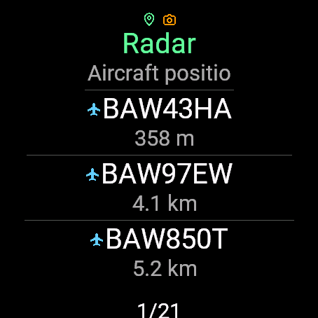
Browse the list of aircraft returned by the ADS-B source, according to your filters. Coverage and available data may vary.
FOR YOUR GARMIN WATCH
That aircraft overhead sparks your curiosity. Check its identification, altitude, speed and distance from your wrist.
RADAR · FLIGHT INFORMATION · SIGHTINGS
01 / THE APP
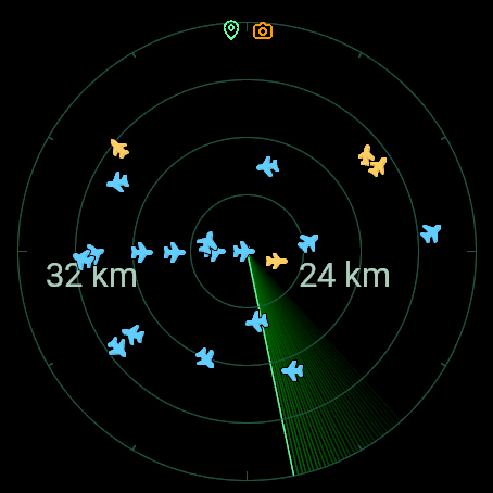
Open the radar, find that aircraft and get the details. Your phone can stay in your pocket.
Browse the list of aircraft returned by the ADS-B source, according to your filters. Coverage and available data may vary.
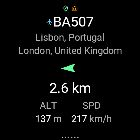
Check its altitude, speed and distance. When origin and destination are available, the route is shown as indicative information.
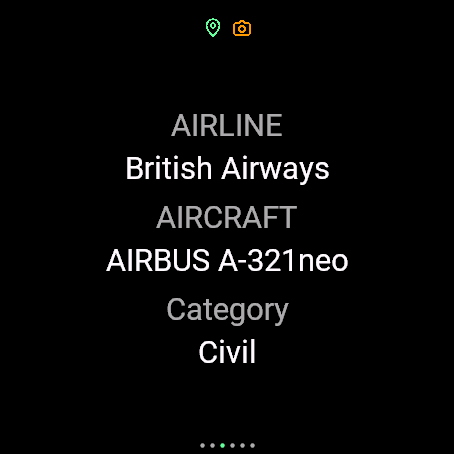
Check the model, registration and photo when available. Send a tracking link to your connected phone.
Garmin simulator screenshots.
02 / THE COMMUNITY · PREVIEW VERSION
Points determine your rank: each sighting earns 1, and confirmed military aircraft earn 1.5. Compare points, unique aircraft and unique models.
If you do not choose a country, your first valid GPS fix assigns it. Travelling does not change it; you can edit it in Garmin Connect. Country rankings add up their explorers’ points.
| RANK | EXPLORER | POINTS | UNIQUE AIRCRAFT | UNIQUE MODELS |
|---|
Loading the leaderboard.
03 / THE RULES
With participation enabled, open an aircraft’s detail on your watch. Each detail request or refresh validates that aircraft against your GPS and ADS-B data; leaving the radar open does not record sightings.
Seeing it on the radar or in the list does not score. An aircraft is evaluated when its detail loads or refreshes with live information. If it enters range while the detail is open, it can count on a later refresh. It earns only one sighting per aircraft per UTC day.
Parked, taxiing and runway aircraft do not score. They count only when ADS-B data indicates they are airborne and they meet the distance limits. Unknown flight state does not score.
Each military sighting confirmed by the API earns 1.5 points; other sightings earn 1 point. GPS, airborne and proximity requirements and the per-aircraft daily limit still apply. Unique aircraft are counted individually, without a multiplier.
A GPS fix no older than 15 seconds, with sufficient quality and altitude available. Manual or saved locations cannot be used to score.
Between your position and the aircraft on the map, checked against ADS-B data.
From your own altitude to less than 3,000 m above you, with both altitudes referenced to mean sea level. Horizontal and vertical limits must be met in the same sample.
Earns one sighting per user per day: 1 point, or 1.5 for confirmed military aircraft. It can score again on another day. A later military confirmation on the same day only adds the remaining half point. Days and months use UTC.
Measurements are GPS and ADS-B estimates. A sample earns no points if data is insufficient or stale. Validating proximity does not confirm that you saw the aircraft.
YOUR NEXT DISCOVERY IS UP THERE
Find Nearby flights in Garmin Connect IQ. The leaderboard is in testing and requires an app version that includes it.
Open Connect IQInstall the appFrom Connect IQ on a compatible watch.
Step outside and open the radarWait for your watch to find your GPS position.
Set your participationThe version with the leaderboard participates by default. After registration, find your alias in Garmin Connect settings; you can change it, choose a country or turn participation off.
BEFORE TAKEOFF
No email or password is required. Each registered installation has a profile identified by a private credential stored on the watch and appears with 0 points before its first sighting. Linking multiple watches and recovering a profile if that credential is lost during reinstallation are not available yet.
Your profile country is shown alongside your alias, points, unique aircraft and unique models. The watch sends GPS coordinates to the API to validate proximity and assign a country automatically. Sighting records do not store those coordinates; they do keep the date, distances, altitudes and GPS quality of the valid sample.
Yes. It is enabled by default in the version with the leaderboard. You can turn it off in Garmin Connect settings or in the watch app. Once the change syncs with the API, your profile disappears from the rankings; saved sightings are kept.
The route is indicative: it is looked up by flight callsign and may be missing, outdated or associated with another operation using the same callsign. The origin and destination are not verified against the flight you are viewing.
With the app visible, participation enabled and a recent GPS fix, it indicates that the API places an aircraft within the airborne, distance and height limits. The watch gives a short vibration, at most once per aircraft per session, if supported. It can appear on the radar without awarding points: to score, open the detail and meet the rules. The hint expires and does not guarantee visibility or a new sighting.
You can choose 10, 30 or 60 seconds. With participation enabled and valid data, the detail can speed up to 5 seconds below 3 km horizontally, 3 seconds below 1.5 km and 2 seconds below 1 km, with the aircraft airborne and from your own altitude to less than 3 km above you. As it moves away, the interval adjusts back. The radar and list keep your chosen interval.
They add up explorers’ points using their current profile country, including in past months. Changing it moves their points to the new country. You can view each country’s total or filter explorers to see their ranks within that country. If GPS cannot assign you a country, you remain in the global ranking. Profiles and countries with 0 points also appear.
Fetching current data and scoring require a connection to the API; opening tracking on a phone requires a connected phone. Offline sightings do not earn points retroactively: each sighting is validated using a recent GPS fix and current aircraft data.
Each aircraft is identified by ICAO hex and counts once in the selected period. Unique models count distinct ADS-B type codes, such as A320 or B738: two different A320s are two aircraft but one model. An aircraft without a known model counts as an aircraft but not as a model. All time includes every recorded aircraft.